Hahn Park at Sunset

Hahn Park at Sunset

Kenneth Hahn Park sits within the Los Angeles basin, half of a cluster of hills bisected by La Cienega Blvd. The western side is an oil field. The eastern side is broken into a maintained city park and something vaguely resembling wilderness, all of it surrounded by suburbs, homes, retail outlets and light industry. Trails run up into the hills, with benches at scenic viewpoints making it possible to have a picnic lunch while you look across the basin to see — depending on which viewpoint and how clear it is that day — Downtown Los Angeles, Hollywood, Santa Monica, the South Bay or the Palos Verdes Peninsula.

This is somewhere along the trail on the western side of the hills, looking north through the valley. I believe the line of buildings in front of the Santa Monica Mountains is Wilshire Blvd.

Chasing the Golden Hour

I wasn’t going to spend a lot of time looking for a good spot to take photos during the golden hour for this week’s photo challenge late Saturday afternoon. There was an open space with electrical towers nearby that I thought would make for some interesting pictures. But the clouds rolled in as I drove down the street, and I spent the next hour racing inland, trying to stay ahead of the marine layer.

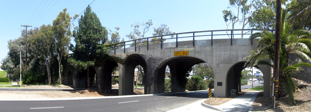
The best shot I got of the bunch, with clouds intermittently covering and revealing the sun, was this one. It’s the historic Pacific Electric Railway Bridge in Torrance, California, which I stumbled across a few years back completely on accident. What makes it an even better choice is that when I first found it, I shot it in broad daylight. You can really see the difference that lighting makes!

Railroad Bridge

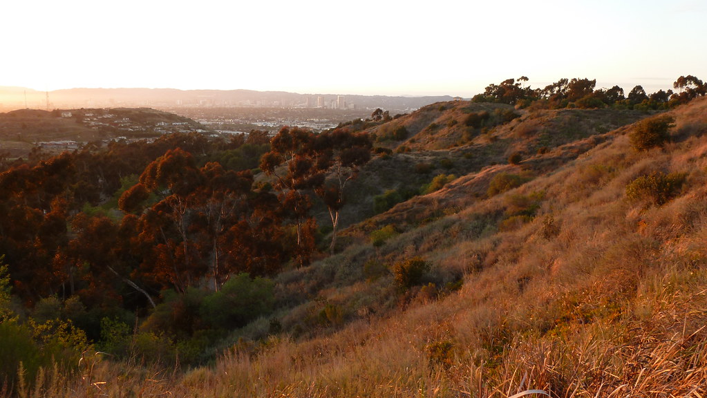
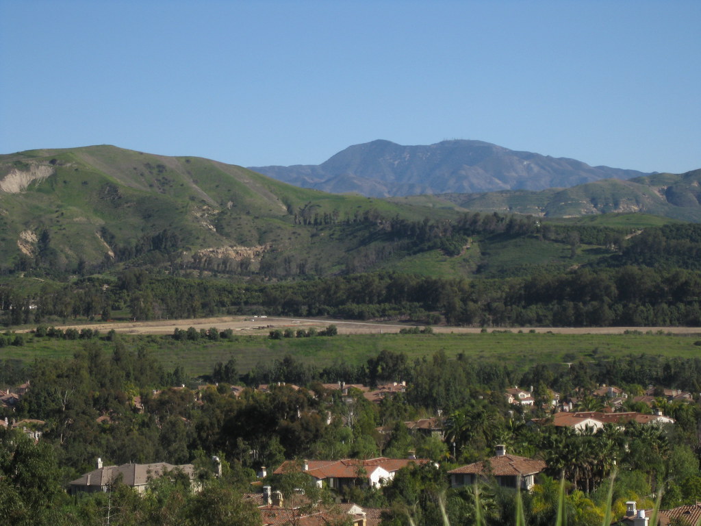
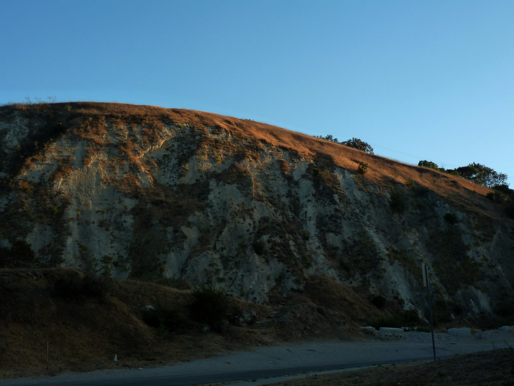
At this point, I started heading into the hills, figuring I’d focus on the clouds instead of the lighting, though on the way I spotted this view of a hilltop lit up by the sun. I could see it from halfway across town, and wasn’t sure I’d make it before the sun dipped too low or the clouds rolled in to block the light.

Hilltop Lit by Sunset

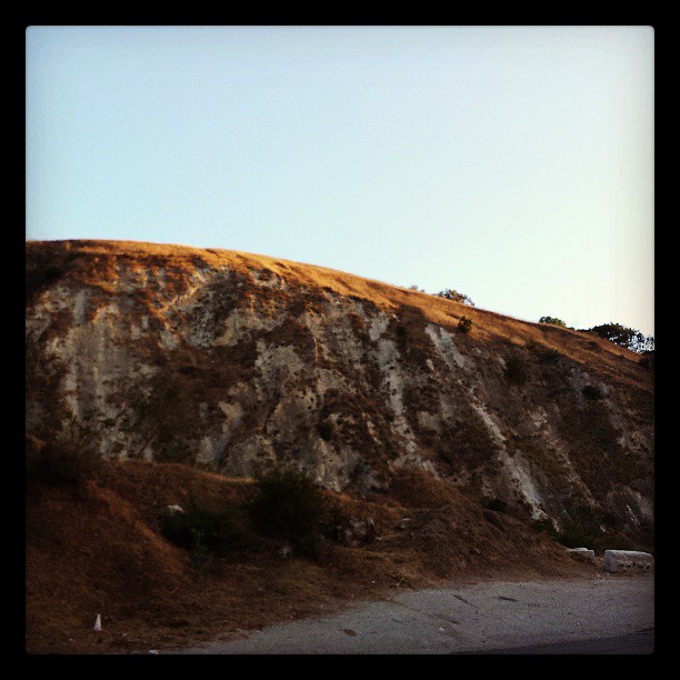
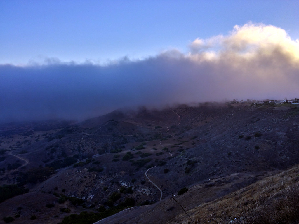
The park I’d planned to go to for views above the cloud layer turned out to be in the cloud layer. The fog was hitting the west face of the hills, moving over, and just barely pouring over the summit ridges. I took my first Instagram video, of low clouds racing across the sky before dissipating.

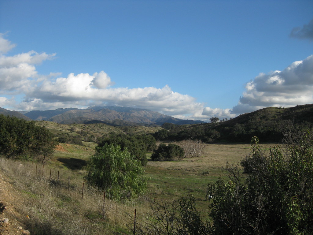
I finally went to another park on the inland side of the hills, and found myself in a clear space surrounded by a wall of clouds to the west and south. This is the view to the west, with the fog backlit by the sun.

Backlit Fog Creeping Over the Hills

This particular park is a great place to get away from it all for a while, so I stuck around for a few minutes to just relax before heading home for the evening.

Curves of Morro Bay

Morro Bay From Afar

Morro Bay lies along the central California Coast near San Luis Obispo, and is known for two major landmarks: Morro Rock, a large volcanic dome right near the shoreline, and a power plant with three very tall smokestacks.

Some miles north, Highway 46 cuts through the coastal mountains from Cambria to Paso Robles, revealing cattle ranches, wineries, and empty hills. There’s one spot along the road where the hills part, revealing a perfect view of the bay and the rock. Better yet, there’s a turnout, making it easy to stop and look.

The first time I drove this way, it was gray and overcast, and might actually have been raining. A year later I took the same drive again on an sunny day, unable to remember how far along the turnout was but watching for it the whole way. The result: this shot.

The curves of the dome, the bay, the rolling hills and the patch of heavier vegetation all fit in with this week’s photo challenge theme.

The Sign Says: Don’t Even Think About It!

Don't Even Think About It!

I couldn’t decide between these two photos for the latest photo challenge. The first is a warning sign at the edge of Del Cerro Park in Rancho Palos Verdes. It’s a part up at the top of the hill, ending in if not exactly cliffs, a steep drop hundreds of feet down as the hills roll toward the ocean.

“Danger” signs are a dime a dozen. It’s the “Don’t even think about it!” that struck me as photo-worthy.

As for this second one, it’s not so much the sign that I found interesting as the fact that the bird looks like it’s staring at it, dismayed.

“Gee, I hope this doesn’t apply to seagulls, too!”

No Fishing Allowed

I collect pictures of funny/odd/interesting signs at K-Squared Ramblings, so if you’re interested in more, head over there for a look.

Mt. Saddleback

Saddleback from Tustin Hills: January 2011

Today is moving day. I’ve spent most of my life in Orange County, where the eastern skyline (when not blocked by trees and buildings) is dominated by the Santa Ana Mountains. The two highest peaks, Santiago Peak and Modjeska Peak, are known locally as Saddleback because of the shape they form together.

We’re not moving far — just to the South Bay — but it’s going to be weird not seeing this landmark on a day-to-day (well, non-smoggy day-to-day) basis. You can see it from that far away, but it takes a very clear horizon and a very clear sky. On a good day I can just make out the silhouette from LAX.

This shot was taken in Lemon Heights, where you can (usually) see a lot more than just the silhouette.

Santiago Canyon in Green

Santiago Canyon after Rain
Santiago Canyon after Rain, originally uploaded by Kelson.

Looking roughly southeast on the side of Santiago Canyon Road, somewhere between Irvine Lake and the turnoff for Silverado Canyon. The peaks of Saddleback, with a dusting of snow barely visible at larger sizes, are shrouded in clouds.

Taken between rainstorms last January.

Layered Hill

Santiago Canyon Layers
Santiago Canyon Layers, originally uploaded by Kelson.

Looking roughly north from Santiago Canyon Road, somewhere between Irvine Lake and Silverado Canyon. I think this was near the point where the road passes over the creek.

In the larger image size, you can see that the rock layers in the hill at the center are tilted diagonally.