Orange: Sky, Flames, Balloon…

The first thing I noticed when going through my photos for the orange challenge is that I take a lot of sunset pictures! I made a point to mix it up and narrowed it down to twelve shots, then checked out how they looked together and settled on six. Then I realized I’d forgotten to upload one, and couldn’t bear to leave it out, bringing the gallery up to seven.

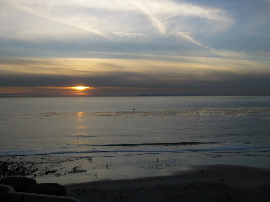
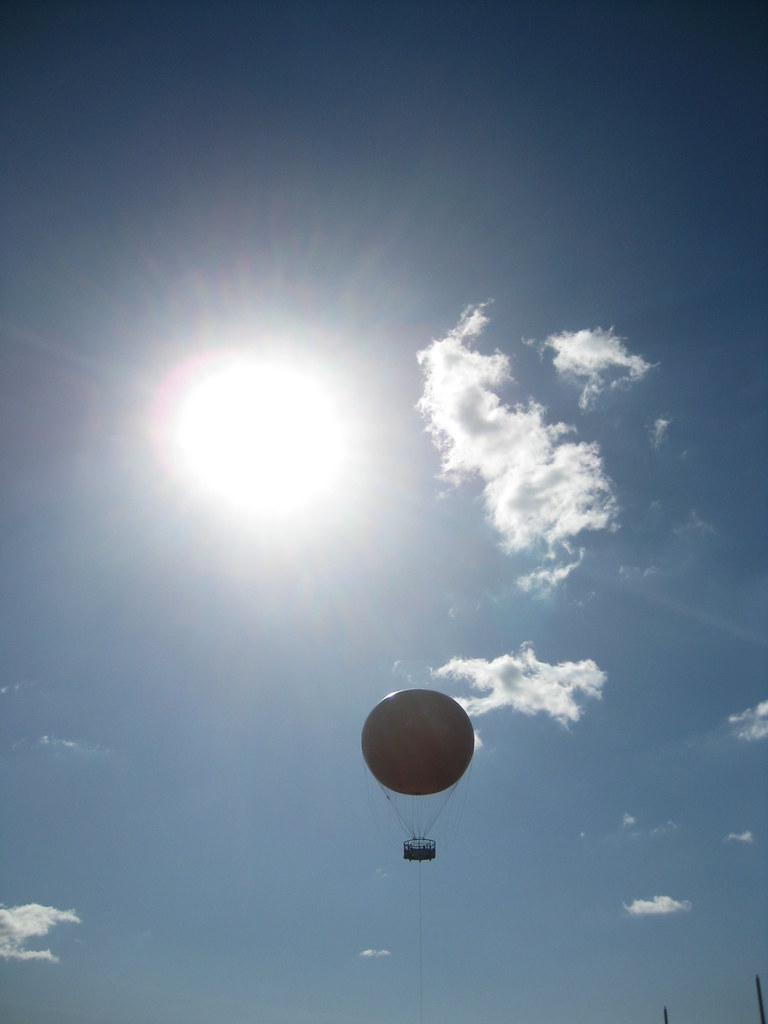
Ragged clouds in a blue sky, lit up yellow-orange just like a Maxfield Parrish painting…a bird of paradise flower…a cosplayer at Comic-Con dressed in a jumpsuit, wielding a Portal gun…ocean waves reflecting another sunset, made even deeper orange than usual by smoke from a wildfire….visiting the big orange balloon at Orange County’s Great Park…torches lighting the gateway to Adventureland at night…and finally a sunset shot, silhouetting the Manhattan Beach Pier…

Abandoned Railroad

Abandoned floppy disk on tracks

This week’s photo challenge is “abandoned” — kind of like this blog was for a few months. 😉

A few years back, I explored a disused spur of railroad tracks branching off of the main line into a light industrial area of town. In many places, the tracks had already been ripped out, leaving only gravel paths (and in some cases stepping stones, as seen below) between buildings that no longer needed freight access.

I found this floppy disk sitting on the track, and the combination of an obsolete data technology and what I thought of at the time as an obsolete transportation technology just struck me.

A path of stepping stones between two buildings.The funny thing is, trains in the form of light rail have made a resurgence in the last few years. Los Angeles’ Metro rail system, started in the 1990s, has expanded dramatically. I actually commuted myself along the Green Line at one point, and while normally that meant driving halfway there to pick up the end of the line, there were a few times I tried picking up a connecting (well, not quite connecting) train from Metrolink, at a station not far from this spot. In fact, the track in the first two photos has since been converted into a footpath connecting a shuttle stop to the commuter rail station.

Mt. Saddleback

Saddleback from Tustin Hills: January 2011

Today is moving day. I’ve spent most of my life in Orange County, where the eastern skyline (when not blocked by trees and buildings) is dominated by the Santa Ana Mountains. The two highest peaks, Santiago Peak and Modjeska Peak, are known locally as Saddleback because of the shape they form together.

We’re not moving far — just to the South Bay — but it’s going to be weird not seeing this landmark on a day-to-day (well, non-smoggy day-to-day) basis. You can see it from that far away, but it takes a very clear horizon and a very clear sky. On a good day I can just make out the silhouette from LAX.

This shot was taken in Lemon Heights, where you can (usually) see a lot more than just the silhouette.

Barn After the Storm

Old Town Irvine After the Storm

Well, technically, it’s Old Town Irvine during a lull in a storm last December. The clouds were moving very fast, with light and shadow moving over the empty fields and office parks, and I waited several minutes for the sun to play over this scene.

I particularly liked the contrast of the dead brown tumbleweeds scattered around the bright green meadow.

My one regret with this photo is not being able to capture the steep drop-off into a wash right below the frame. I could get the wash, or the sky, but not both.

Santiago Canyon in Green

Santiago Canyon after Rain
Santiago Canyon after Rain, originally uploaded by Kelson.

Looking roughly southeast on the side of Santiago Canyon Road, somewhere between Irvine Lake and the turnoff for Silverado Canyon. The peaks of Saddleback, with a dusting of snow barely visible at larger sizes, are shrouded in clouds.

Taken between rainstorms last January.

Santa Ana Mountains Snow II

Santa Ana Mountains Snow from Irvine

According to Flickr, this is my most interesting* photo that isn’t someone in costume at a fan convention. It’s #68 on the list!

The photo was taken December 18, 2008, after a storm passed through Orange County and did something unusual: it blanketed the Santa Ana Mountains with snow. Saddleback typically gets a light dusting a couple of times a year, and the next peak down sometimes gets a little snow that melts by noon, but it’s rare for the snow to reach any lower.

The vantage point is a housing development on Quail Hill, looking southeast over the Irvine Spectrum area. You can see the Great Park Balloon near the left. Saddleback itself is out of frame to the right, but you can see its base (the peaks are covered in clouds) in the panorama I shot at the same time.

*Flickr’s “interestingness” is a measure that combines a count of views, comments, and “favorites.” The exact balance is secret, but from what I can tell, comments outweigh favorites, which outweigh views.

Nighttime Fair From Above

OC Fair from Above at Night
OC Fair from Above at Night, originally uploaded by Kelson.

Looking down at the carnival area of the 2009 Orange County Fair from the top of the Ferris wheel. This was the end of a busy afternoon and evening at the fair that encompassed “Weird Al” Yankovic’s 3-D brain, a concert, and the horrifying realization that at the fair, people will fry anything. Is the world ready for the Zucchini Weenie?

Layered Hill

Santiago Canyon Layers
Santiago Canyon Layers, originally uploaded by Kelson.

Looking roughly north from Santiago Canyon Road, somewhere between Irvine Lake and Silverado Canyon. I think this was near the point where the road passes over the creek.

In the larger image size, you can see that the rock layers in the hill at the center are tilted diagonally.

Santa Ana Mountains Snow

Saddleback Snow Quail Hill View
Santa Ana Mountains Snow – Quail Hill View, originally uploaded by Kelson.

Monday’s storm didn’t leave much snow on Saddleback (though the San Gabriel Mountains were pretty well covered), but it’s been cold enough that I half-suspect this weekend’s storm will leave a bit more.

So here are a couple of views of the Santa Ana Mountains and the Irvine Spectrum from last December, seen from Quail Hill. The first was taken the morning after the storm ended. The second was taken the following day at lunchtime. I’ve also got a full panorama taken at the same time as the first photo.

Santa Ana Mountains Snow - Quail Hill Revisited
Santa Ana Mountains Snow – Quail Hill Revisited, originally uploaded by Kelson.

Crystal Court Twilight

Crystal Court Twilight

Here’s a flashback to another Friday the 13th, three years ago. That evening, my wife and I went to the nearest Borders to pick up The End of Lemony Snicket’s Series of Unfortunate Events and Neil Gaiman’s new short story collection, Fragile Things. We ended up crossing the bridge over to the main section of the mall, turned around, and saw an amazing twilight display with clouds silhouetted against the blue.

We stopped to take pictures. We weren’t the only ones.

Perhaps an hour later, the rainstorm arrived.