Abandoned Railroad

Abandoned floppy disk on tracks

This week’s photo challenge is “abandoned” — kind of like this blog was for a few months. 😉

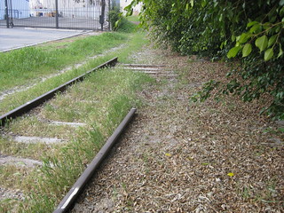
A few years back, I explored a disused spur of railroad tracks branching off of the main line into a light industrial area of town. In many places, the tracks had already been ripped out, leaving only gravel paths (and in some cases stepping stones, as seen below) between buildings that no longer needed freight access.

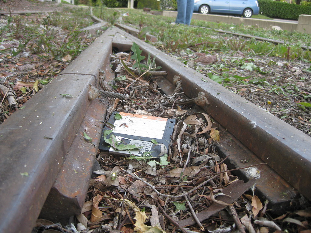
I found this floppy disk sitting on the track, and the combination of an obsolete data technology and what I thought of at the time as an obsolete transportation technology just struck me.

A path of stepping stones between two buildings.
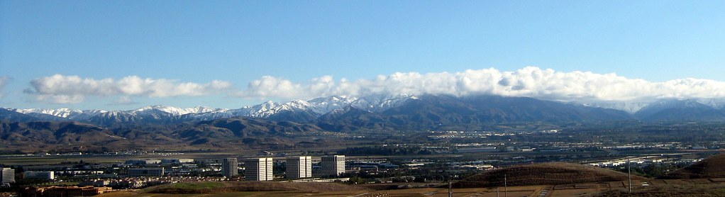
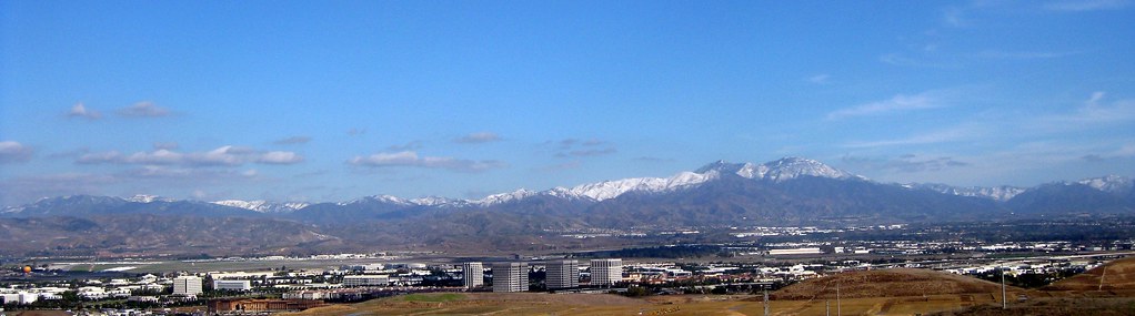
The funny thing is, trains in the form of light rail have made a resurgence in the last few years. Los Angeles’ Metro rail system, started in the 1990s, has expanded dramatically. I actually commuted myself along the Green Line at one point, and while normally that meant driving halfway there to pick up the end of the line, there were a few times I tried picking up a connecting (well, not quite connecting) train from Metrolink, at a station not far from this spot. In fact, the track in the first two photos has since been converted into a footpath connecting a shuttle stop to the commuter rail station.

TODO: Import to K2R, link forward and back to Obsolete (2009).
QUESTION: Import the original 2014 post (with suitable tag/link changes), or update the text and post it as new? Also connect to this Mastodon post (local archive copy)

Mt. Saddleback

Saddleback from Tustin Hills: January 2011

Today is moving day. I’ve spent most of my life in Orange County, where the eastern skyline (when not blocked by trees and buildings) is dominated by the Santa Ana Mountains. The two highest peaks, Santiago Peak and Modjeska Peak, are known locally as Saddleback because of the shape they form together.

We’re not moving far — just to the South Bay — but it’s going to be weird not seeing this landmark on a day-to-day (well, non-smoggy day-to-day) basis. You can see it from that far away, but it takes a very clear horizon and a very clear sky. On a good day I can just make out the silhouette from LAX.

This shot was taken in Lemon Heights, where you can (usually) see a lot more than just the silhouette.

Barn After the Storm

Old Town Irvine After the Storm

Well, technically, it’s Old Town Irvine during a lull in a storm last December. The clouds were moving very fast, with light and shadow moving over the empty fields and office parks, and I waited several minutes for the sun to play over this scene.

I particularly liked the contrast of the dead brown tumbleweeds scattered around the bright green meadow.

My one regret with this photo is not being able to capture the steep drop-off into a wash right below the frame. I could get the wash, or the sky, but not both.

Santiago Canyon in Green

Santiago Canyon after Rain
Santiago Canyon after Rain, originally uploaded by Kelson.

Looking roughly southeast on the side of Santiago Canyon Road, somewhere between Irvine Lake and the turnoff for Silverado Canyon. The peaks of Saddleback, with a dusting of snow barely visible at larger sizes, are shrouded in clouds.

Taken between rainstorms last January.

Santa Ana Mountains Snow II

Santa Ana Mountains Snow from Irvine

According to Flickr, this is my most interesting* photo that isn’t someone in costume at a fan convention. It’s #68 on the list!

The photo was taken December 18, 2008, after a storm passed through Orange County and did something unusual: it blanketed the Santa Ana Mountains with snow. Saddleback typically gets a light dusting a couple of times a year, and the next peak down sometimes gets a little snow that melts by noon, but it’s rare for the snow to reach any lower.

The vantage point is a housing development on Quail Hill, looking southeast over the Irvine Spectrum area. You can see the Great Park Balloon near the left. Saddleback itself is out of frame to the right, but you can see its base (the peaks are covered in clouds) in the panorama I shot at the same time.

*Flickr’s “interestingness” is a measure that combines a count of views, comments, and “favorites.” The exact balance is secret, but from what I can tell, comments outweigh favorites, which outweigh views.

Santa Ana Mountains Snow

Saddleback Snow Quail Hill View
Santa Ana Mountains Snow – Quail Hill View, originally uploaded by Kelson.

Monday’s storm didn’t leave much snow on Saddleback (though the San Gabriel Mountains were pretty well covered), but it’s been cold enough that I half-suspect this weekend’s storm will leave a bit more.

So here are a couple of views of the Santa Ana Mountains and the Irvine Spectrum from last December, seen from Quail Hill. The first was taken the morning after the storm ended. The second was taken the following day at lunchtime. I’ve also got a full panorama taken at the same time as the first photo.

Santa Ana Mountains Snow - Quail Hill Revisited
Santa Ana Mountains Snow – Quail Hill Revisited, originally uploaded by Kelson.

Whoa! That’s real far!

I walked to lunch at the Irvine Spectrum today. On my way back, while waiting at a red light, a 20-ish guy with headphones and a student-sized backpack asked me for directions to UCI — on foot. As it happened, the directions were simple: Take Barranca to Jeffrey, turn left, and keep going.

But 7 miles is a long way to walk!

He did ask if there were any buses that went there. I said there were, but I didn’t know where the stops were for that route.

If he kept walking, he might be just arriving around now.

Lunchtime observations

All the “meadows” (i.e. weed fields) I noted a while back have been mowed down and just look like dead brown grass. The one where I stopped and watched birds and butterfies has a few flowers that have popped up since then, but is otherwise pretty much dead.

Speaking of dead grass, the traffic island where I took the picture of the Grass Under Renovation sign is almost completely dead now.

Jamba Juice gets really loud when they’re making lots of smoothies.

A green tea boost turns mango smoothies green. I’d hate to see what it does to a berry smoothie. With luck it’ll look sort of like a mocha… but it sure won’t taste like one!

I suspect the local schools are out, since there were a lot more teenagers than I’m used to seeing on a weekday. That’s part of why Jamba Juice was so busy.

As I was leaving with my smoothie, a pair of girls waiting to pick theirs up suddenly hugged each other and started dancing in circles for no apparent reason.

Many of the trees along the path from the building where I work to the Spectrum shopping center are purely decorative. The sidewalk along Irvine Center Drive is lined by trees on both sides, but only a few shadows managed to touch the sidewalk. As for shade for someone walking at high noon? Not a chance. Maybe in a few more years they’ll be useful. Or maybe if the city doesn’t trim them back so far next year.

This lack of shade may be connected to the lack of pedestrians. Today, for instance, I encountered no one on the way to lunch until I reached the office building across the street from the center. On the way back there was one guy carrying a soda and a bag from fye, and a woman jogging with an iPod. And they were both on the first block out, before the first signal.

Speaking of that first signal (second if you count the one crossing the street from the Spectrum itself)…drivers don’t expect pedestrians there either. A truck was turning right in front of me as the light changed, and another car zoomed right behind it despite me stepping forward into the street. By the time I got three steps in, the “don’t walk” signal was already flashing… and this is nine lanes worth of street.

A matter of perspective

Yes, you really do notice different things on foot than in a car. For instance: after the heavy rains this past winter, all the empty lots in the Irvine Spectrum area are full of weeds. But in spring, when the weeds are green and in bloom, those fields look an awful lot like meadows.

The lot (or meadow) in front of the Ford building, in particular, had so many birds wheeling and swooping above it that I stopped to watch, and also spotted butterflies and a ladybug that zoomed past my hand to land on the bag of allergy medication I always carry whenever I go somewhere to eat. (I moved it over to the hedge I was standing next to and waited for it to jump off.) A bit later in the walk I started to notice bird songs, and something I couldn’t quite identify as a very loud cricket, a frog, or just a gravelly-voiced bird.

Not all the empty lots look like this. The one nearest the building where I work is, at this very moment, being reduced to stubble by some guy on a power mower.

A Tale of Three OCs

Well, the office is closed today for the company Christmas party, which for the first time in several years I’m not attending. (It’s out on an Indian casino/resort, and with our usual Dec. 24 holiday being unnecessary, they moved it around so people could beat the traffic.) But since alenxa’s office isn’t, and we only have one car, I had to get up early anyway.

I decided, on a whim, to go exploring a bit. I’ve recently developed an interest in local geography and trying to associate what landforms I can see at a distance with actual locations I can stand on or point to on a map. So I headed toward the mountains, looking for a way past Foothill Ranch. I didn’t make it up into the mountains, but I did find a beautiful drive through what I think was Trabuco Canyon, with twisty, oak-lined back roads, semi-isolated feed stores, random diners in the middle of nowhere, clear views of the mountains—all just a few miles outside my usual haunts.

It made me realize there are actually three Orange Counties: North County (flat and urban), South County (hilly and willfully suburban), and the canyons (willfully rural), which for some reason I’d been including in South County in my mental demographic map.

We’re definitely going to have to explore this further.

Old Town, New Town

Ever since I found out there was actually an area called “Old Town Irvine,” I’ve found the idea somewhere between funny, pretentious, and oxymoronic. Looking at nearby cities, we have Old Town Orange, a collection of streets with shop buildings dating back to the late 1800s or early 1900s, centered around an actual traffic circle. The place could have been the model for Disneyland’s Main Street. There’s Old Town Tustin, another collection of streets with shops going back to the late 1800s or early 1900s, with contemporary houses nearby for good measure.

Then, there’s Old Town Irvine, a couple of barns that have been converted into restaurants and a motel. Why? Because there effectively is no Old Town Irvine — it sprang whole from a designer’s master plan in the late 1960s. Most people assume UCI is named after the city, but it actually predates the city of Irvine. Both were named after the Irvine Ranch (or possibly the Irvine Company or the Irvine family — all three are tied together) on which they were built. Maybe 50 years from now there really will be an “old town” — and it’ll probably be Northwood or Woodbridge or something. But the name will already have been trademarked by the shopping center, so they won’t be able to use it.